Garmin
Garmin TopoActive Europe 2022.10 Software
Posted by envasel at Feb. 12, 2023
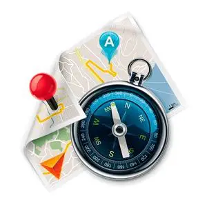
Garmin TopoActive Europe 2022.10 | 12.49 GB
Orienteer and reference any outdoor or recreational activity in European countries with this map, compiled using the community-generated OpenStreetMap (OSM) database.
Garmin City Navigator Maps NT 2020.10 Multilingual Software
Posted by Artist14 at Sept. 16, 2019
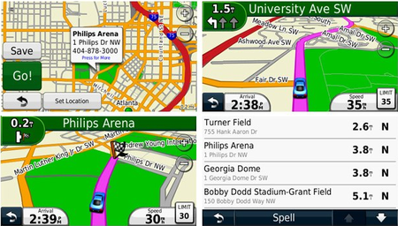
Garmin City Navigator Maps NT 2020.10 Multilingual | 12.8 GB
Navigate the streets with confidence. This product provides detailed road maps and points of interest for your device, so you can navigate with exact, turn-by-turn directions to any address or intersection.
City Navigator Europe NT Unicode 2024.20 Software
Posted by envasel at Sept. 15, 2023
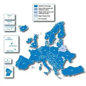
City Navigator Europe NT Unicode 2024.20 | 19.08 GB
Navigate the streets of Europe with confidence. This product provides detailed road and landmark maps for your compatible device, so you can navigate with precise guidance, turn-by-turn to any address or intersection. Directions to restaurants, gas stations, lodging, attractions and more. Includes full coverage of Romania, Guadeloupe, Martinique, Saint Barthelemy and French Guiana. Detailed coverage for Bosnia and Herzegovina has increased. Includes more than 10.8 million km (6.7 million miles) of roads, including motorways, national and regional highways and local roads, in Western Europe and many Eastern European countries. Displays over 6.7 million points of interest across the country, including restaurants, lodging, border crossings, attractions, gas stations, campsites, shops and much more. Provides turn-by-turn directions on your compatible device. Pronunciation for compatible devices that speak street names (for example, "Turn right on Main Street"). Includes navigation features such as avoiding unwanted areas, choosing a route view, and more. Contains traffic data for compatible devices that use receiver traffic.
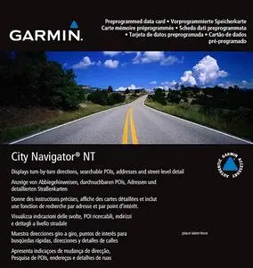
City Navigator Europe NT 2022.10 [All] Software
Posted by envasel at Dec. 10, 2021
![City Navigator Europe NT 2022.10 [All]](https://pixhost.icu/avaxhome/aa/92/008a92aa_medium.jpg)
City Navigator Europe NT 2022.10 [All] | 12.56 GB
Navigate the streets of Europe with confidence. This product contains detailed road maps and points of interest for your compatible device, so you can navigate with precise directions, turn-by-turn directions to any address or intersection. Route to restaurants, gas stations, lodging, attractions and more. Includes full coverage of Romania, Guadeloupe, Martinique, Saint Barthelemy and French Guiana. Detailed coverage increased for Bosnia and Herzegovina. Includes over 10.8 million km (6.7 million miles) of roads, including highways, national and regional highways and local roads, in Western Europe and many countries in Eastern Europe. Displays over 6.7 million points of interest nationwide, including restaurants, accommodations, border crossings, attractions, gas stations, campgrounds, shops and more. Provides turn-by-turn directions on a compatible device. Pronunciation for compatible devices that speak street names (for example, “Turn right onto Main Street.”) Includes navigation features such as avoiding unwanted places, route selection, and more. Contains traffic data for compatible devices that use receiver traffic.
City Navigator Europe NT Unicode 2022.20 Software
Posted by envasel at Nov. 16, 2021

City Navigator Europe NT Unicode 2022.20 | 24.58 GB
Navigate the streets of Europe with confidence. This product contains detailed road maps and points of interest for your compatible device, so you can navigate with precise directions, turn-by-turn directions to any address or intersection. Route to restaurants, gas stations, lodging, attractions and more. Includes full coverage of Romania, Guadeloupe, Martinique, Saint Barthelemy and French Guiana. Detailed coverage increased for Bosnia and Herzegovina. Includes over 10.8 million km (6.7 million miles) of roads, including highways, national and regional highways and local roads, in Western Europe and many countries in Eastern Europe. Displays over 6.7 million points of interest nationwide, including restaurants, accommodations, border crossings, attractions, gas stations, campgrounds, shops and more. Provides turn-by-turn directions on a compatible device. Pronunciation for compatible devices that speak street names (for example, “Turn right onto Main Street.”) Includes navigation features such as avoiding unwanted places, route selection, and more. Contains traffic data for compatible devices that use receiver traffic.
City Navigator Europe NT Unicode 2022.10 Software
Posted by envasel at June 12, 2021
City Navigator Europe NT Unicode 2022.10 | 18.1 GB
Navigate the streets of Europe with confidence. This product contains detailed road maps and points of interest for your compatible device, so you can navigate with accurate directions, turn-by-turn directions to any address or intersection. Route to restaurants, gas stations, lodging, attractions and more. Includes full coverage of Romania, Guadeloupe, Martinique, Saint Barthelemy and French Guiana. Detailed coverage increased for Bosnia and Herzegovina. Includes over 10.8 million km (6.7 million miles) of roads, including highways, national and regional highways and local roads, in Western Europe and many countries in Eastern Europe. Displays over 6.7 million points of interest nationwide, including restaurants, accommodations, border crossings, attractions, gas stations, campgrounds, shops and more. Gives turn-by-turn hints on a compatible device. Pronunciation for compatible devices that speak street names (for example, "Turn right onto Main Street") Includes navigation features such as avoiding unwanted places, route selection, and more Contains traffic data for compatible devices that use receiver traffic.
City Navigator North America NT 2024.10 Software
Posted by envasel at Sept. 27, 2023
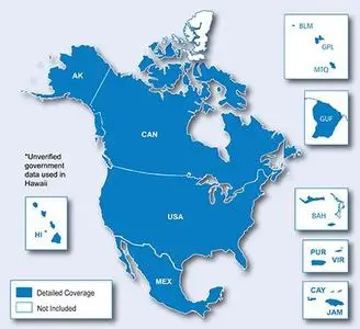
City Navigator North America NT 2024.10 | 5.21 GB
Navigate the streets with confidence. This product provides detailed road maps and points of interest to your device so you can navigate with precise turn-by-turn directions to any address or intersection.
Quick Terrain Modeller (USA) 8.3.2.1 (x64) Software
Posted by Magictor at Sept. 2, 2022
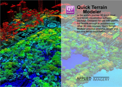
Quick Terrain Modeller (USA) 8.3.2.1 (x64) | 993.6 Mb
Quick Terrain Modeler is the world’s premier 3D point cloud and terrain visualization software package. Designed for use with LiDAR, but flexible enough to accommodate other 3D data sources, Quick Terrain Modeler provides an easy to use software experience that allows users to work with significantly more data, render larger models, analyze data faster, and export a variety of products. These benefits enable very powerful, yet simple and intuitive, terrain exploitation.
BackCountry Navigator TOPO GPS 6.4.5 Software
Posted by Samsan at Feb. 17, 2017
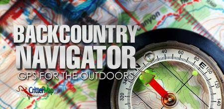
BackCountry Navigator TOPO GPS 6.4.5 | Android | 17.6 MB
Download topo maps for an offline outdoor navigator! Use your phone or tablet as an offroad topo mapping handheld GPS with the bestselling outdoor navigation app for Android! Explore beyond cell coverage for hiking and other recreation. Download topo maps for the US and many other countries in advance, so you won't need cell coverage for navigation. Use storage memory for maps. Use GPS waypoints from GPX or KML files, or enter your own coordinates using longitude/latitude, UTM, MGRS, or grid reference. Using GOTO makes a waypoint a locus for navigation.
Runtastic PRO Running, Fitness v8.2 [Paid] Software
Posted by Orten at Jan. 30, 2018
![Runtastic PRO Running, Fitness v8.2 [Paid]](https://pixhost.icu/avaxhome/cc/23/005023cc_medium.png)
Runtastic PRO Running, Fitness v8.2 [Paid] | Android | 40 MB
Ready to get in shape? Get started to with the Runtastic GPS Running & Fitness PRO app and start tracking your fitness activities (distance, time, speed, elevation, calories burned & more) - such as running, jogging, biking & walking using GPS. Plus it’s fully optimized for Android Wear. Ready to run?