Lidar
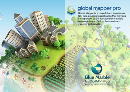
Blue Marble Global Mapper Pro 23.1.0 Software
Posted by scutter at Feb. 21, 2022
Blue Marble Global Mapper Pro 23.1.0 | 359.4 mb
Blue Marble Geographics is pleased to announce the immediate availability of Global Mapper 23.1.0 build 021522. Equally well suited as a standalone spatial data management tool and as an integral component of an enterprise-wide GIS, Global Mapper is a must-have for anyone who works with maps or spatial data.
Exelis ENVI 5.3.1 Software
Posted by scutter at Oct. 18, 2021
Exelis ENVI 5.3.1 | 2.7 Gb
The Harris Geospatial Solutions, Inc , develops products for the visualization, analysis, and management of geospatial imagery and scientific data, has unveiled ENVI 5.3.1. This update packed full of new features and functionality that will help you do more with your geospatial data than ever before.
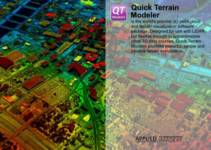
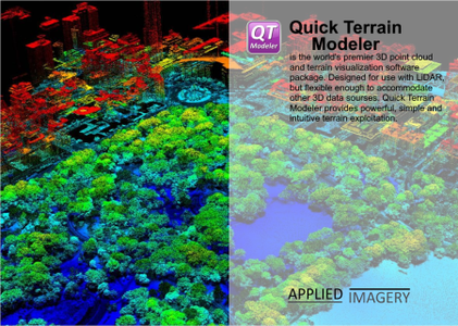
Applied Imagery Quick Terrain Modeler 8.4.0 with Sample Data Software
Posted by scutter at Nov. 25, 2022
Applied Imagery Quick Terrain Modeler 8.4.0 with Sample Data | 2.2 Gb
Applied Imagery is pleased to announce the release of QT Modeler 8.4.0, which solves one of our users’ biggest problems: access to geospatial data.
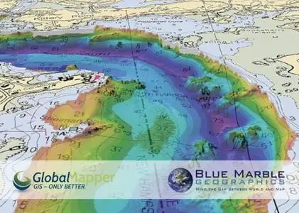
Blue Marble Global Mapper 21.1.0 Software
Posted by scutter at June 8, 2020
Blue Marble Global Mapper 21.1.0 | 455.3 mb
Blue Marble Geographics is pleased to announce the immediate availability of Global Mapper version 21.1. Equally well suited as a standalone spatial data management tool and as an integral component of an enterprise-wide GIS, Global Mapper is a must-have for anyone who works with maps or spatial data.
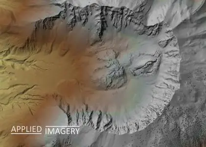
Applied Imagery Quick Terrain Modeler 8.3.2 Software
Posted by scutter at June 13, 2022
Applied Imagery Quick Terrain Modeler 8.3.2 | 1.0 Gb
Applied Imagery is pleased to announce the release of QT Modeler 8.3.2 is a professional three-dimensional point cloud processing and terrain visualization software.
Applied Imagery Quick Terrain Modeller 8.2.0.0 Software
Posted by scutter at Feb. 24, 2020
Applied Imagery Quick Terrain Modeller 8.2.0.0 | 627.8 mb
The Applied Imagery Team announced a major new release of its flagship product, Quick Terrain Modeller 8.2.0.0, the world's premier 3D point cloud and terrain visualization software package.
MathWorks MATLAB R2020a v9.8.0.1380330 (Win / macOS / Linux) Software
Posted by Artist14 at May 14, 2020

MathWorks MATLAB R2020a v9.8.0.1380330 (Win / macOS / Linux) | 60 GB
Includes MathWorks MATLAB R2020a Update 2 only
Includes MathWorks MATLAB R2020a Update 2 only
Millions of engineers and scientists worldwide use MATLAB to analyze and design the systems and products transforming our world. MATLAB is in automobile active safety systems, interplanetary spacecraft, health monitoring devices, smart power grids, and LTE cellular networks. It is used for machine learning, signal processing, image processing, computer vision, communications, computational finance, control design, robotics, and much more.
MathWorks MATLAB R2020a v9.8.0.1359463 (Win / macOS / Linux) Software
Posted by Artist14 at April 22, 2020
MathWorks MATLAB R2020a v9.8.0.1359463 (Win / macOS / Linux) | 56.7 GB
Includes MathWorks MATLAB R2020a Update 1 only
Includes MathWorks MATLAB R2020a Update 1 only
Millions of engineers and scientists worldwide use MATLAB to analyze and design the systems and products transforming our world. MATLAB is in automobile active safety systems, interplanetary spacecraft, health monitoring devices, smart power grids, and LTE cellular networks. It is used for machine learning, signal processing, image processing, computer vision, communications, computational finance, control design, robotics, and much more.
MathWorks MATLAB R2020a v9.8.0.1396136 (Win / macOS / Linux) Software
Posted by Artist14 at June 11, 2020
MathWorks MATLAB R2020a v9.8.0.1396136 (Win / macOS / Linux) | 65.1 GB
Includes MathWorks MATLAB R2020a Update 3 only
Includes MathWorks MATLAB R2020a Update 3 only
Millions of engineers and scientists worldwide use MATLAB to analyze and design the systems and products transforming our world. MATLAB is in automobile active safety systems, interplanetary spacecraft, health monitoring devices, smart power grids, and LTE cellular networks. It is used for machine learning, signal processing, image processing, computer vision, communications, computational finance, control design, robotics, and much more.
Quick Terrain Modeller (USA) 8.4.0.82836 (x64) Software
Posted by Magictor at Nov. 25, 2022

Quick Terrain Modeller (USA) 8.4.0.82836 (x64) | 1 GB
Quick Terrain Modeler is the world’s premier 3D point cloud and terrain visualization software package. Designed for use with LiDAR, but flexible enough to accommodate other 3D data sources, Quick Terrain Modeler provides an easy to use software experience that allows users to work with significantly more data, render larger models, analyze data faster, and export a variety of products. These benefits enable very powerful, yet simple and intuitive, terrain exploitation.